| |
Hurricane Irene could hit East Coast
By Knoxville Daily Sun Staff
August 23, 2011, 4:28 pm
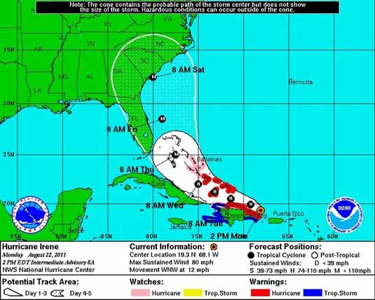
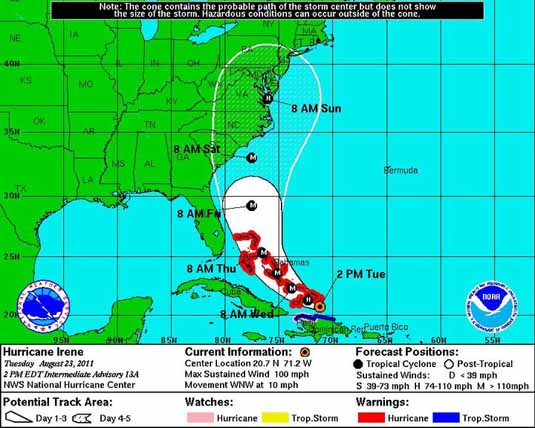
The above images show how Hurricane Irene is progressing and moving from yesterday and today. Images compliments East Tennessee Storm Team. |
Most meteorologists are keeping a close eye on Hurricane Irene: currently building size and momentum along the East Coast of Cuba and the north side of the Dominican Republic.
The storm has increased to a category 2 and is expected to continue to increase to a category 3 by the end of the day (Tuesday, August 23, 2011). If that is the case, all likelihood would suggest that it will continue to increase to a category 4 or 5 by the end of the week.
The storm is moving north toward America's east coast. Yesterday, the fear was and uncertainty was for 3 states (Florida, Georgia and South Carolina). Today all indications suggest that Florida and Georgia will be spared, but the threat is not over and will remain for most of the entire east coast.
After speaking with Josh Marler of East Tennessee Storm Team, the current predictions are: If it does make landfall it will be Friday night – Saturday morning on the East Coast of South Carolina.
A lot of what happens depends on the current cold front experienced in the Eastern USA. |
